Tips For Driving Safely Around Tampa Bay In The Wake Of Hurricane Idalia
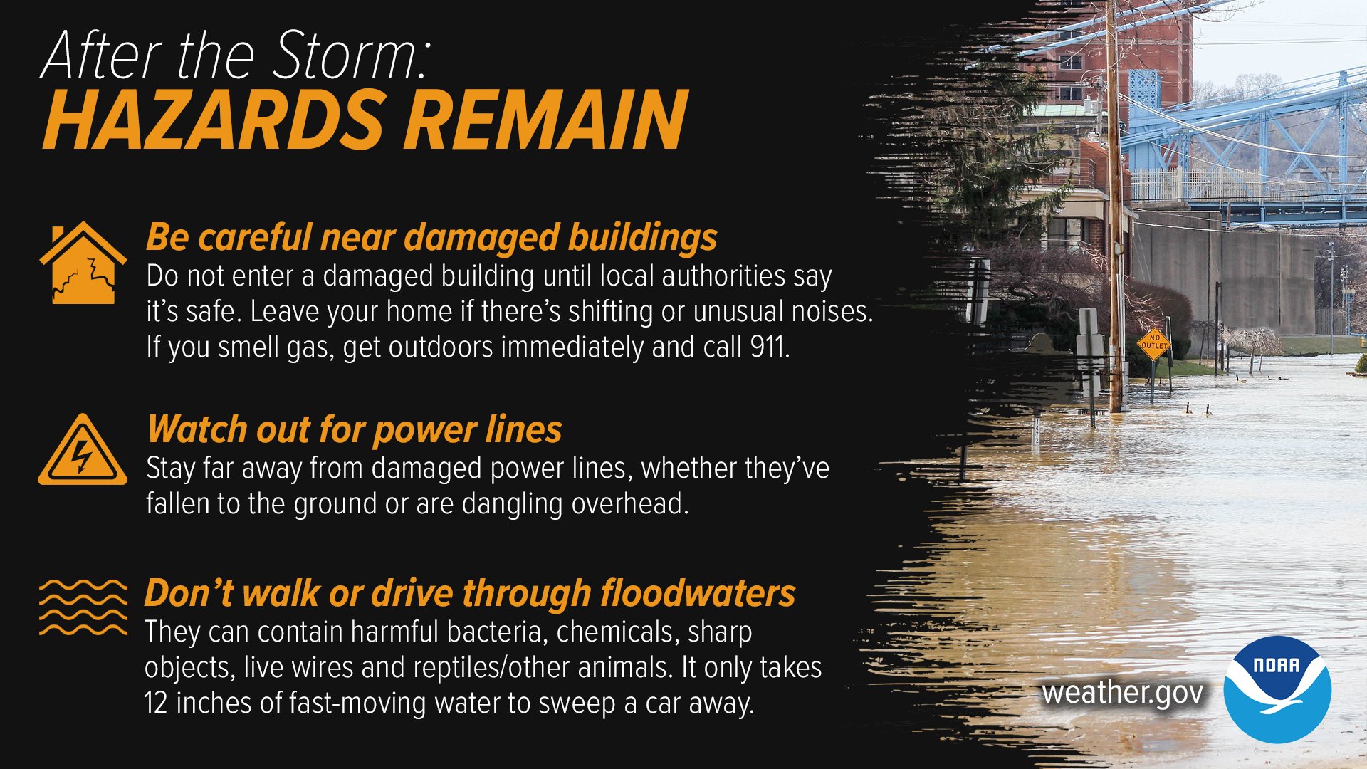
Do you have to drive anywhere around Tampa Bay now that Hurricane Idalia has passed through? Officials are asking residents to NOT attempt to drive through the high waters.
If you don’t have to drive anywhere, sit tight and stay safe at home. But if you do have to be out on the roads or highways, here are some tips to ensure that you do not endanger yourself or other drivers.
With wet roads and puddles, you don’t want to put yourself in a situation where you are putting yourself in danger of getting in an accident. Nor do you want to flood your car.
Here are three tips to help you through the treacherous, hazardous driving conditions. First of all, if you are on a highway, for example, U.S. 19, stay in the middle of the three lanes. That is the highest point, and you will be less likely to slosh and careen in puddles. And you’ll be less likely to splash water onto other vehicles, potentially obstructing another driver’s vision. If the highway has two lanes, your better bet is to stay on the inside lane.
Be wary of other drivers who might be acting like looky-loos. A driver is staring at a downed tree or an emergency vehicle, and then they plow into you. Likewise, don’t you be a looky-loo.
Also, if you see water and you can’t tell how deep it is, don’t test it out with your vehicle!
A little side note, with water overshooting retention ponds, animals (like alligators) may not be chilling in their normal habitat. They might make it onto a Tampa Bay roadway so you want to make sure you are driving safely.
Stay off your phone while you’re driving, my friend. Be safe!
Hurricane Idalia Makes Landfall in Florida
Important Reminders
From the National Weather Service…